
If you are active on HF or non-repeater VHF/UHF frequencies, you should know your operational grid square when making contacts. Many hams need to know your exact location for logging and awards purposes. The grid square system was adopted by the IARU for specifying amateur radio station location in a relatively small area.

The planet is divided up into 32,400 grid squares roughly 100mi wide by 70mi high (in continental USA) per the Maidenhead Locator System. More detail here.
Basically, our planet is divided into 18×18=324 fields identified by two letters (AA-RR)
Each field is 20° longitude (east-west) and and 10° latitude (north-south). The first letter represents longitude and the second latitude as shown below.
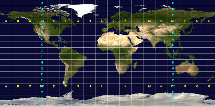
Each field is sub-divided into 10×10=100 squares starting again in the southwest counting north in columns of tens and shifting east for the next ten.
If you look carefully at field IO above (encompassing most of the UK and Ireland), you can see this refined grid. It looks like this in a more geodetic (less flat) view:
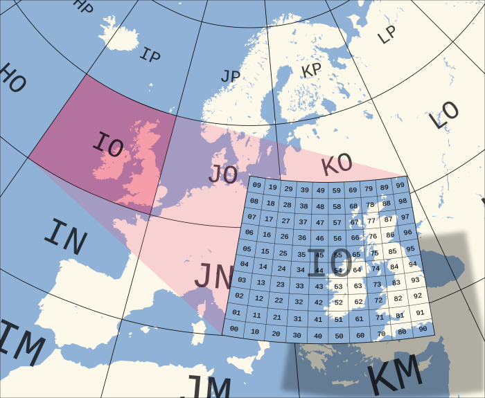
Here you can clearly see square 00, lower left and 99, upper right with the other 98 squares everywhere in between.
This combination of field plus square gives us the basic grid square system. It follows the specific format as shown below.

Of interest to most readers of this site, the continental United States (CONUS) is Continue reading
